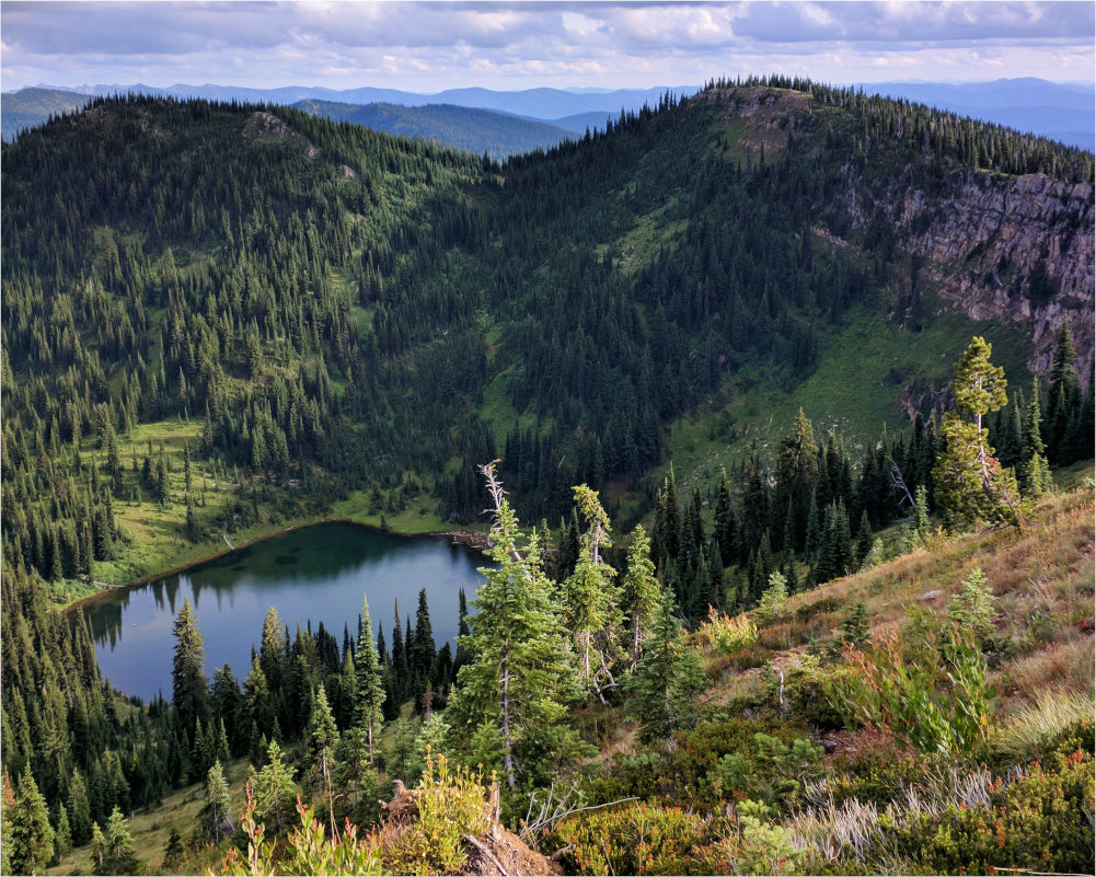
Meadow Creek is 215,000 acres watershed on the Nez Perce National Forest. A vital fishery for salmon, steelhead, and bull trout, and needed addition to the Selway-Bitterroot Wilderness.
As one saying goes, “the deer doesn’t cross the road, the road crosses the forest.” It can be easy to see nature from a human-centric view, where roads provide access to resources and communities.
From nature’s point of view, roads introduce many problems, such as:
Constant sediment pollution in streams and rivers, degrading habitat for trout and salmon
Increased encounters between grizzly bears and humans, which are often deadly for bears
Decreased security for elk, leading to smaller bulls and problems in calves
Noxious weed expansion along roadsides
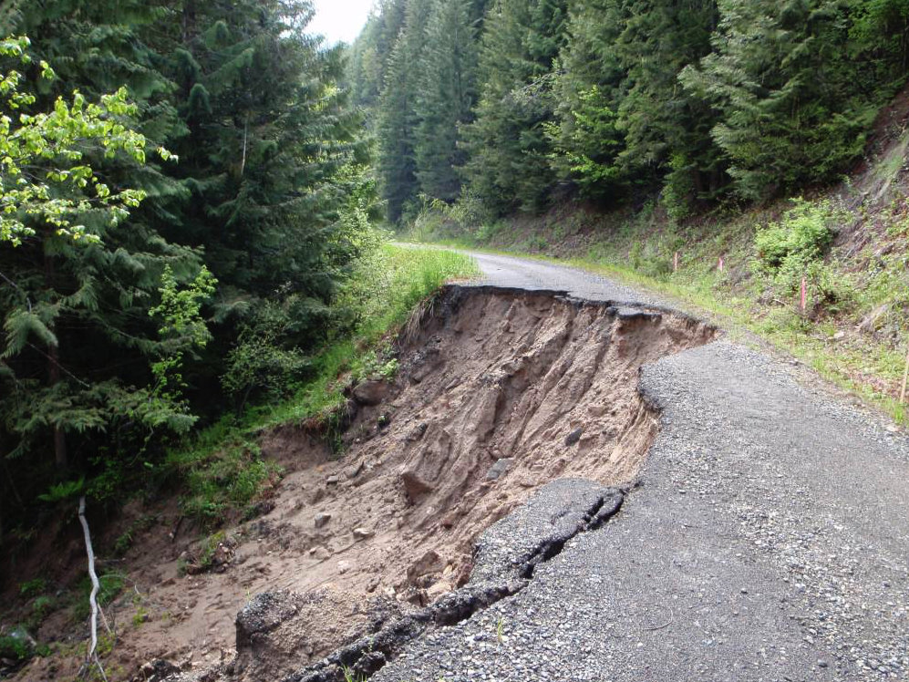
Changes to groundwater flow, including increased landslides
Motorized impacts, which disproportionately affect sensitive species like wolverines
There are over 260,000 miles of system roads on the national forests, about five-and-a-half times more than the US interstate system.
That doesn’t include many closed roads, “temporary roads”, or motorized trails. In comparison, there are just 5,000 miles of roads in all the national parks.
Meadow Creek is 215,000 acres watershed on the Nez Perce National Forest. A vital fishery for salmon, steelhead, and bull trout, and needed addition to the Selway-Bitterroot Wilderness.
Ferns, red alder, cedar, and fungi mark the inland rainforest of the Mallard-Larkins. This large roadless area is overwhelmingly green, excepting the stony peaks of the Pioneer Area.
Fish and Hungery creeks (the largest tributaries of the Lochsa) are prime steelhead streams. The roadless area lies between the Lochsa to the south and the Lolo motorway to the north.
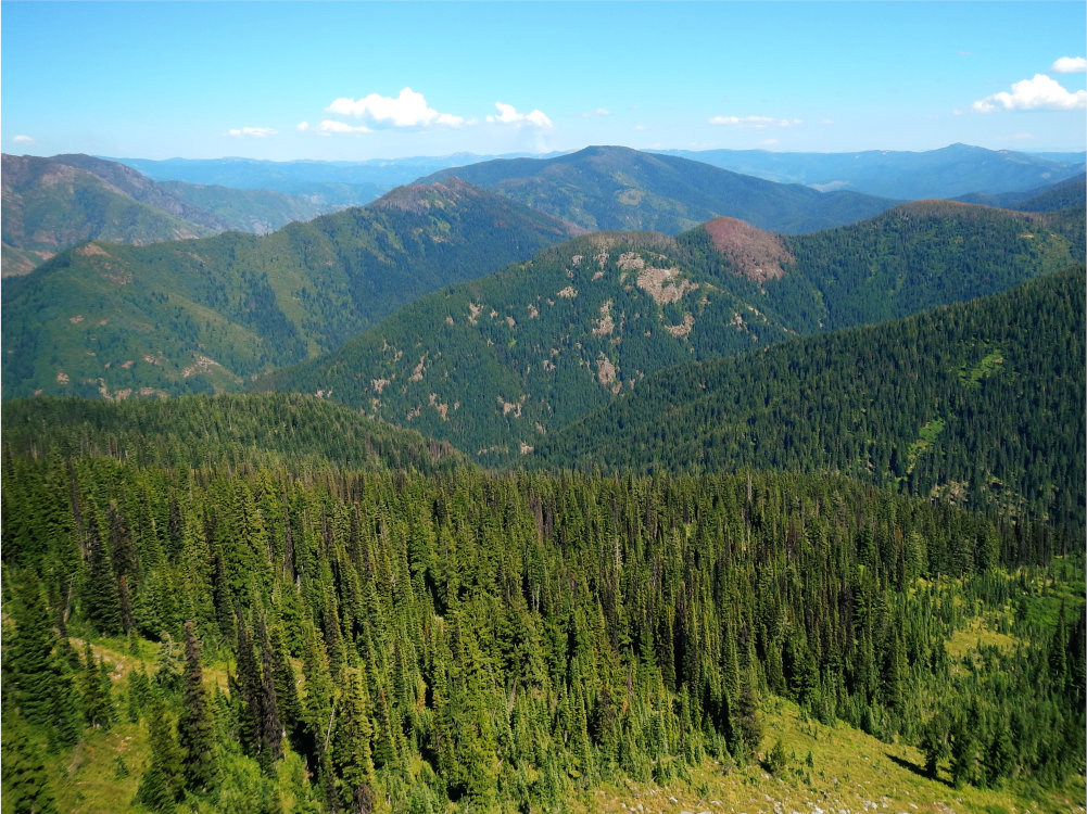
Weitas Creek is the largest roadless area in the Clearwater Basin. It is a verdant and diverse landscape, bounded by the North Fork of the Clearwater to the north and the Lolo Motorway to the south.
The Great Burn, named in memory of the epic 1910 wildfires, is the crown of the Bitterroots. It stretches from Kelly Creek in Idaho to nearly the Clark Fork River in Montana.
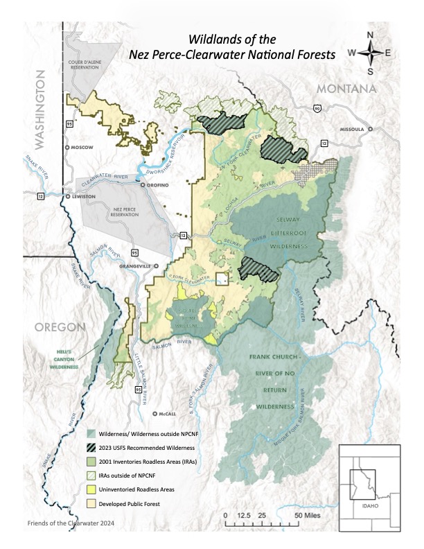
*O'Hara-Falls Creek and Lick Point RAs are separated from the Selway-Bitterroot Wilderness by one and two roads, respectively. Dixie Summit/Nut Hill is divided by one road from the Gospel-Hump Wilderness. These three are the "adjacent" areas in the complexes and are separate Wildernesses in the Northern Rockies Ecosystem Protection Act (NREPA).
†Acreage for John's Creek is a rough estimate. It is not inventoried.
Friends of the Clearwater
PO Box 9241
Moscow, ID 83843
(208) 882-9755