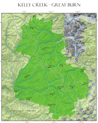
Kelly Creek (Great Burn or Hoodoo) Roadless Area is a vast 255,000 acre expanse of wild country straddling the Montana/Idaho border along the Bitterroot Divide. The long and high divide runs north-south roughly 40 miles. From the ridges on either side emanate both large and small fast-moving streams, draining into the Clearwater Basin on the Idaho side (where the majority of Kelly Creek sits) and the Clark Fork drainage in Montana. The area burned heavily in the great fire of 1910, leaving charred snags, grassy slopes, and expanses of sub-alpine tundra-like meadow, hence the name Great Burn.
Noted for its rocky outcrops, cliffs, and jagged peaks, Kelly Creek boasts a varied topography with elevation ranging from 3,200 feet at the mouth of Moose Creek to peaks such as Rhodes and Williams rising nearly 8,000 feet. Much of the divide sits above 6,500 feet. Impressive stands of mountain hemlock and dozens of clear lakes nestled in arena-like cirques adorn the high country, with cheerful mountain heather dotting the slopes.
A cedar-hemlock-pine forest canopies upper elevations, primarily grand fir, Douglas fir, larch, modest stands of white pine on the Idaho side, and ponderosa pine at lower and drier elevations. Also prolific are verdurous, fragrant pockets of ancient western red cedar, some over 500 years old, which shelter such sensitive plants as Mingan moonwort, Bank monkey flower, clustered lady slipper, and Idaho strawberry.
A spruce-fir system populates the Montana side, with stretches of Engelmann spruce, sub-alpine fir, and mountain hemlock, with lodgepole pine copious over burned areas. A few whitebark pines can be found above 6,000 feet. Throughout the area, below the explorer’s feet rolls a mossy carpet of sword and maidenhair ferns. Along the higher ridges, especially Williams Peak to Shale Mountain, craggy pinnacles and thin, irregular rocky formations often called “dinosaur rocks” for their resemblance to prehistoric creatures, stand sentry to the sweeping vistas.
Prior to the arrival of Euro-Americans, the native people used various natural animal crossings on the divide to wait for animals to migrate or be driven. At least four Indian trails, including the Lolo Trail along the southern boundary, as well as Native American camp areas, a vision quest site, lithic (or stone-tool making) workshops, and game traps existed. Today, the area is still favored country for elk hunting. In addition, mule deer and black bear abound, and an estimated 20-50 mountain goats trek the rock-ribbed high country along the Bitterroot Divide. Moose, mountain lions, and many species of furbearers inhabit this wild expanse, taking advantage of the exceptional summer range. An unfortunate illegal killing of a grizzly in 2007, and more than ten unconfirmed sightings of threatened grizzly bear over the past thirty years, suggest this area is essential habitat. Furthermore, Lynx and several Region 1 sensitive species find Kelly Creek a hospitable environment.
Kelly Creek and all its tributaries have been catch-and-release streams since 1970 to enhance Westslope-cutthroat populations. Twelve to fifteen-inch fish are not uncommon, lending national recognition to the drainage. Most of the larger streams and lakes support cutthroat and rainbow trout (landlocked steelhead since the construction of Dworshak Reservoir). Fish Lake, threatened with off-road vehicles, is important habitat for bull trout. Ironically, the Forest Service promotes motorized use in an area it recommends for wilderness!
The size and diversity of the area, the variety of vegetative types and landforms, the abundance of wildlife, streams, and lakes all contribute to a virtually unlimited primitive setting for recreation in, and appreciation of, the wild. The vastness of this region, with 40 plus streams dissecting the area, trees and shrubs and varied mountainous terrain effectively isolates visitors from each other and provides excellent opportunity for solitude. Kelly Creek Roadless Area is a critical biological link between the massive Selway-Bitterroot Wilderness to the south and the Greater Cabinet-Yaak ecosystem to the north. Full protection of this regional wildland is essential to curb damaging snowmobile and off-road vehicle use in the Idaho side, and to curtail the potential for speculative mining ventures.
Go back to main undeveloped wildlands page.